Networks
This section consists of a map and a table and is mainly intended to depict the locations from where attacks are attempted and the hosts that get targeted in them.
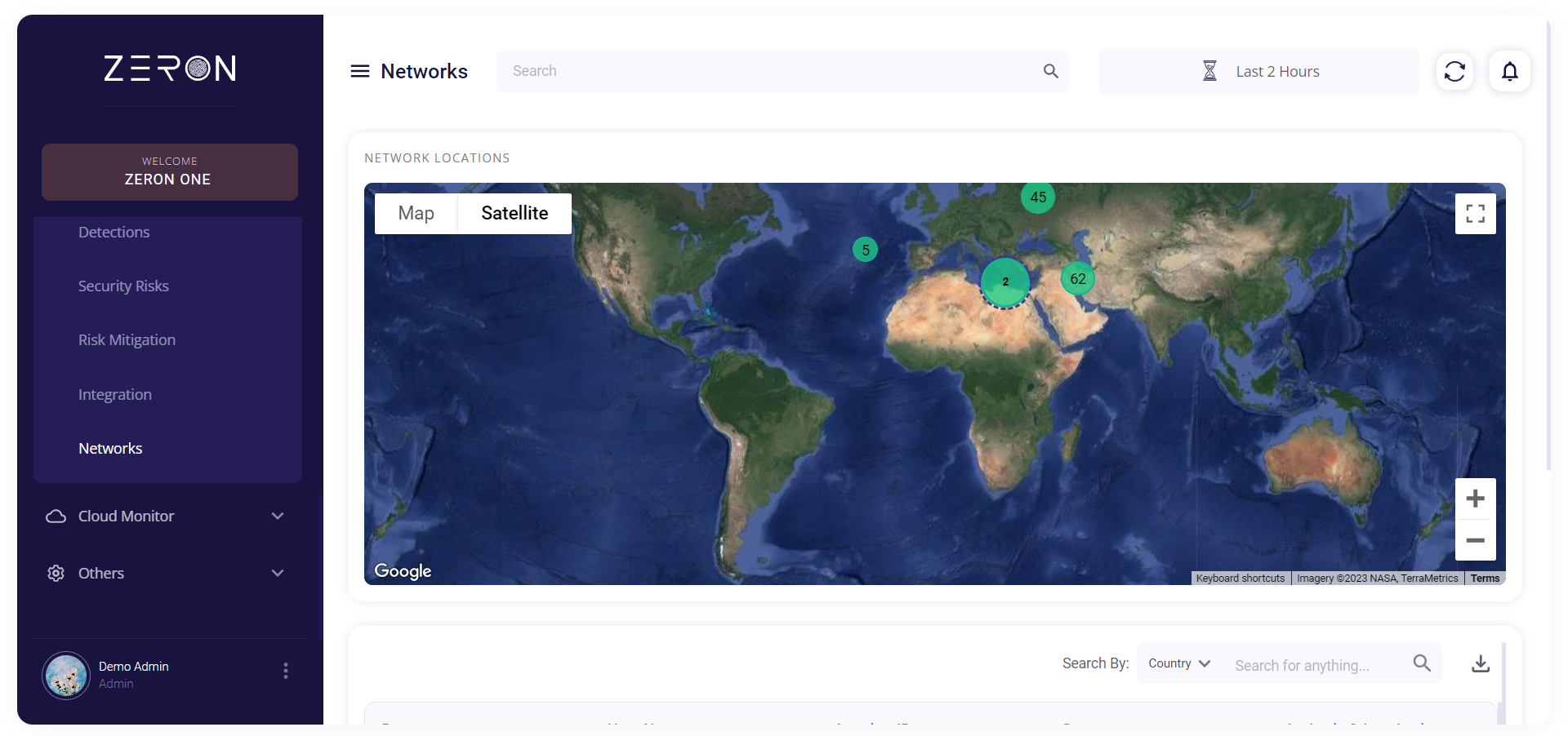
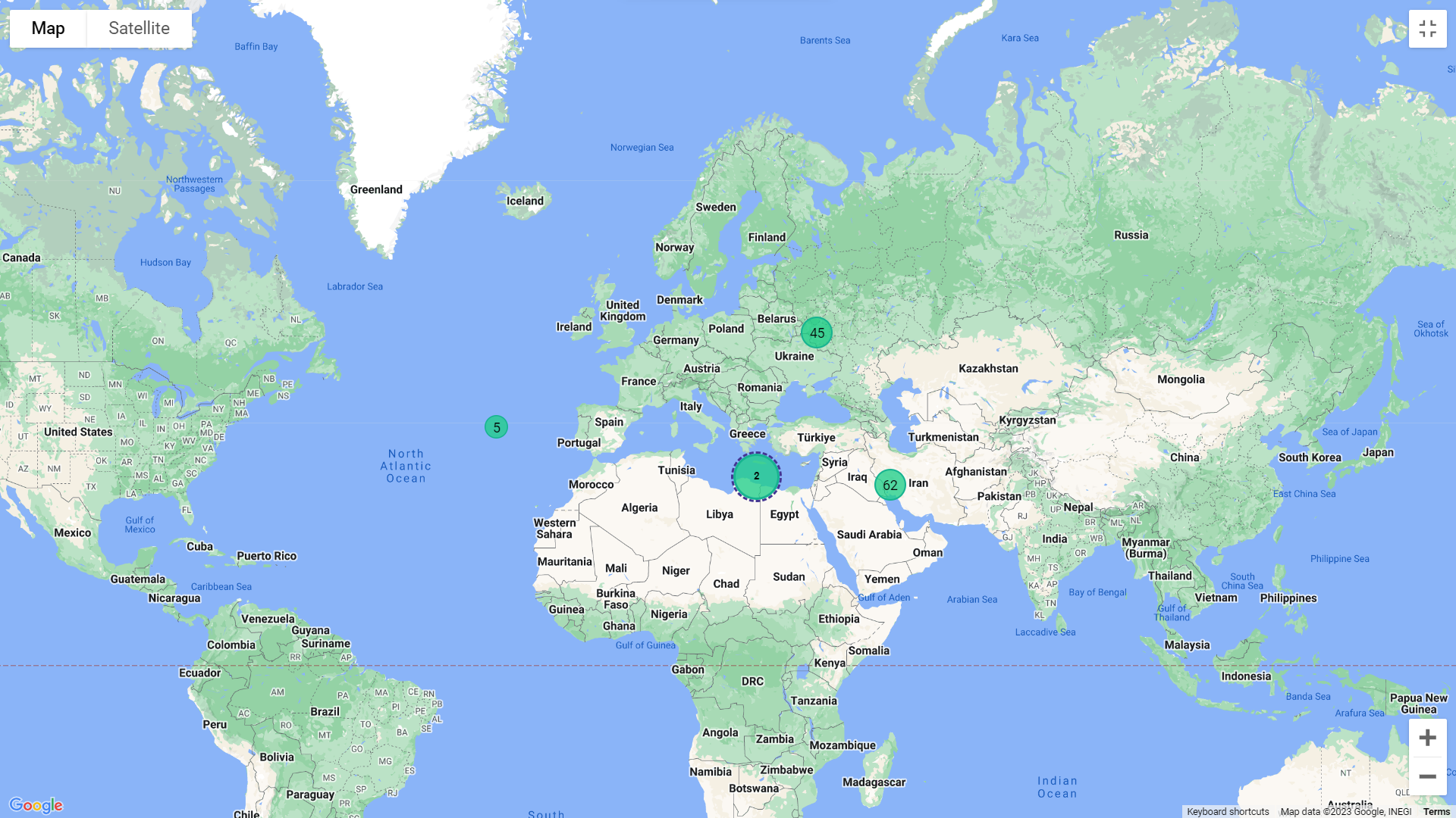
The top section consists of a Google map. The number of attacks for each area is shown on the map and can be clicked to get more subdivisions. The map can be rendered in two different ways:
- Terrain view
- Satellite view (with or without labels)
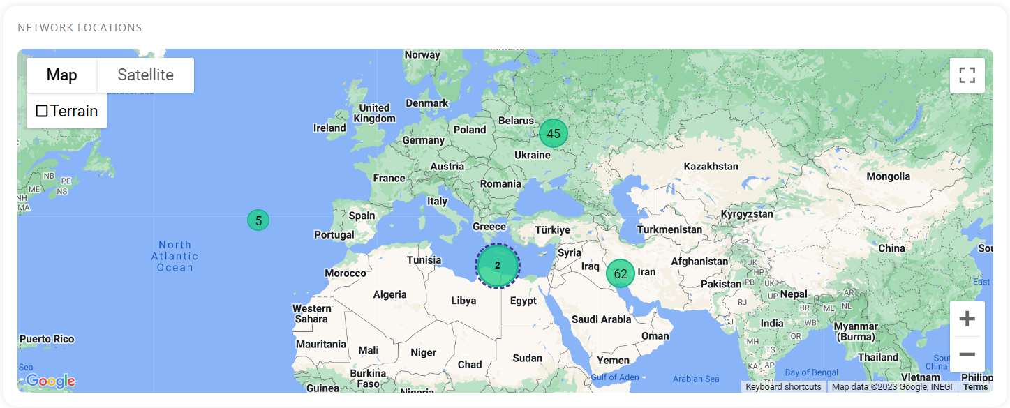
Terrain view
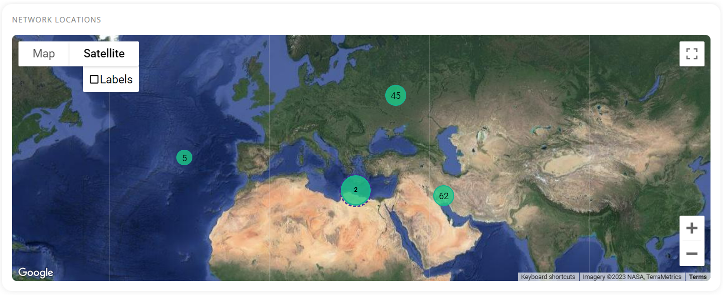
Satellite view
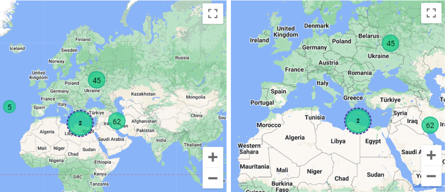
Clicking on the full-screen icon at the top left corner enables the user to get an expanded view of the chosen type.
The minimize and maximize buttons at the bottom right corner can be used to zoom in and out of the map.
The second half of this section consists of a table providing the following details about the attempted attacks:
- Date
- Host name
- Attacker IP
- Country
- Latitude & Longitude
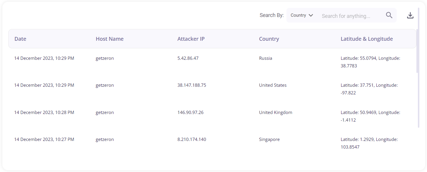
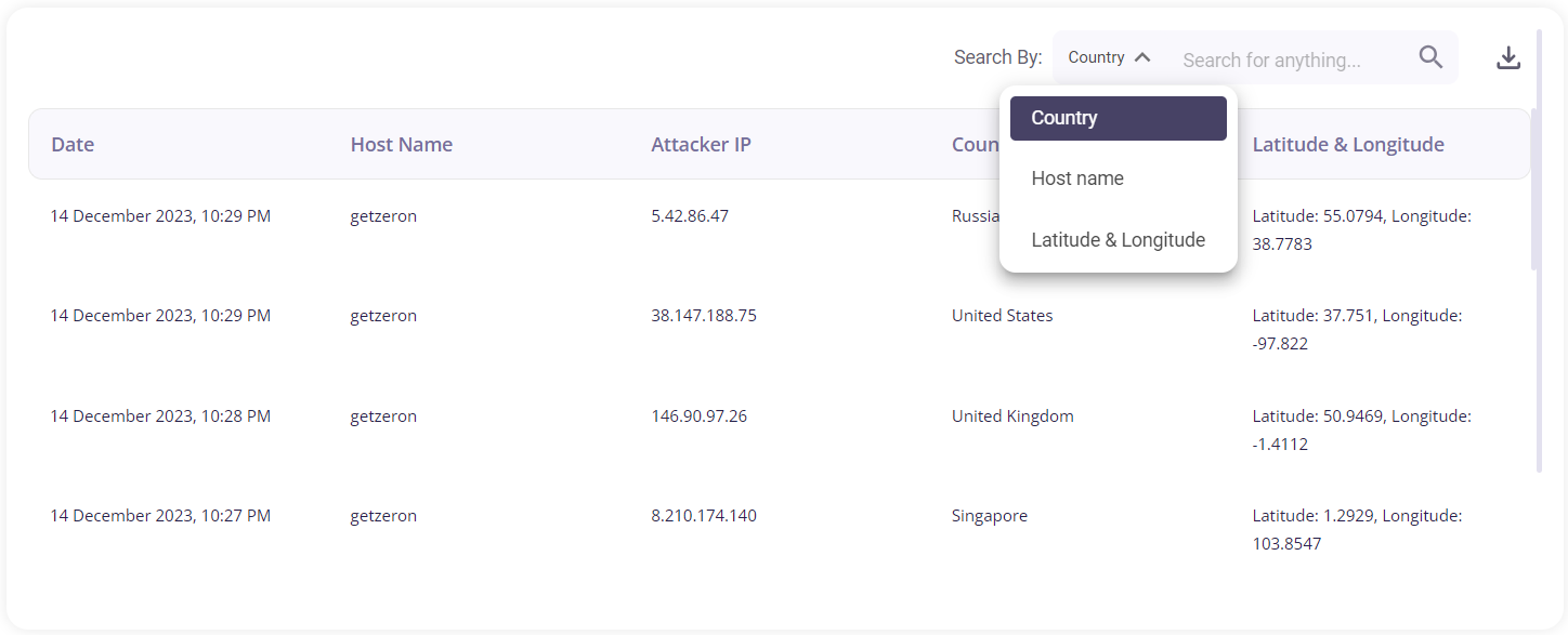
The user can search for a particular attack based on the Country, Host name, or Latitude & Longitude by clicking on the dropdown menu provided in the search bar. A log of the attempted attacks can be downloaded as a .csv file by clicking on the download button and then selecting the 'export as .csv' option.
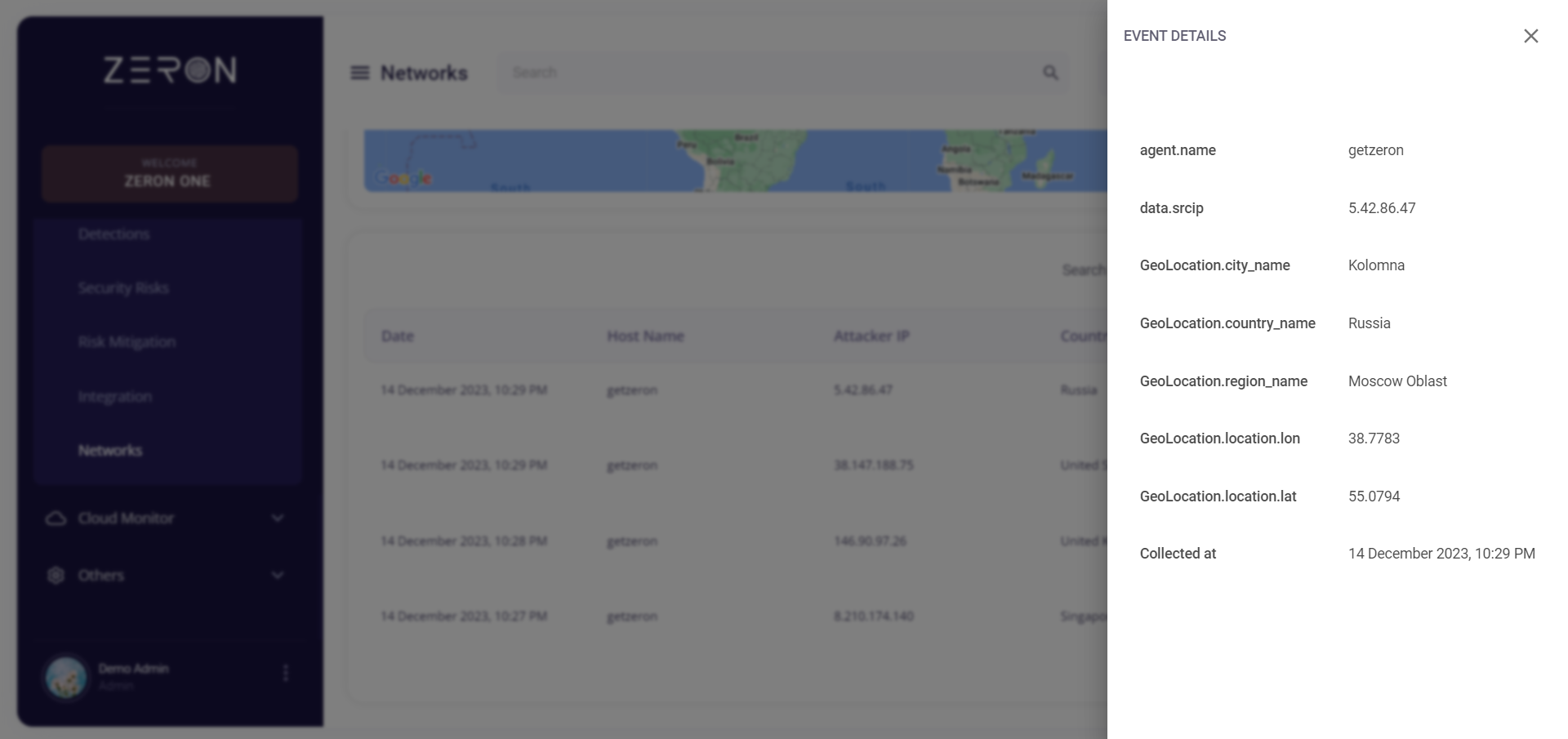
Clicking on a particular attack would provide the user with further details about it.